Perusahaan ini terdaftar sebagai Free Member. Hindari melakukan pembayaran sebelum bertemu penjual atau melihat barang secara langsung. COD (Cash On Delivery) atau bertemu langsung dengan penjual merupakan metode transaksi aman yang kami sarankan.
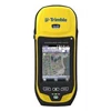
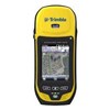
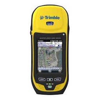
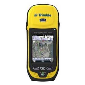
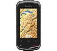
Keterangan Trimble GeoXT 6000 ( Standard Edition) with Terrasync Pro Designed for work For utility companies, municipalities, environmental management agencies, and many other organisations, timely accurate information is paramount to good decision making. The GeoXT handheld is the ideal field device for organizations mapping critical assets and infrastructure, or for anyone needing dependable submeter accuracy GNSS data, simple operation, and repeatable results. In conjunction with a Trimble Mapping & GIS field software application or a custom application developed by a Trimble Mapping & GIS Business Partner, the GeoXT handheld is the ideal platform for: Utilities: Asset surveys, meter inspections, incident and outage reporting. Local government: High density urban asset mapping, municipal asset inventory and inspection. Environmental management: Weed management, wildlife monitoring, pollution mapping, environmental incident mapping, sample gathering, urban forest management. The GeoXT handheld is an ideal solution in any industry requiring a mobile submeter accuracy mapping data collection and maintenance solution. To discuss the opportunities for a customised high accuracy data collection or maintenance solution for your industry using the Trimble GeoExplorer 6000 series GeoXT handheld, contact your local Trimble reseller. 220 channel GNSS receiver Submeter real-time and 50 cm postprocessed accuracy Integrating the latest in Trimble GNSS receiver technology, with the optional ability to track both GPS and GLONASS satellites, the GeoXT handheld delivers consistent submeter accuracy in real time and 50 cm accuracy after postprocessing. Even higher levels of postprocessed accuracy are possible if GNSS carrier data is logged for extended periods. Trimble Floodlight satellite shadow reduction More positions and increased accuracy in tough environments With the optional Trimble Floodlight satellite shadow reduction technology option installed, the GeoXT receiver can compute positions even with very weak satellite signals. Floodlight technology increases the number of positions that are gathered in difficult locations, and boosts accuracy in those places where normally only low accuracy data is available. With the GeoXT handheld, field crews can now work with fewer disruptions, meaning means better data, faster, at less cost. Read more: Floodlight technology brief. Smart Settings Set and forget GNSS configuration for better results in all conditions The GeoXT handheld is fully supported by the latest versions of Trimble field software which include seamless out-of-the-box receiver configuration and Smart Settings. Using Smart Settings, the GNSS receiver can calculate the optimal accuracy each second without imposing strict masks, and without sacrificing productivity. There is no need to adjust settings from one location to the next— simply activate Smart Settings, and let the receiver do the rest. 4.2 " polarized display Crystal clear text, photos, and maps— even in direct sunlight The GeoXT handheld includes a sunlight-optimized display designed specifically for outdoor operation. It maintains exceptional clarity in all outdoor conditions, including direct sunlight. Text is crisp and easy to read. Background maps and photos are rich and vibrant. At 4.2 " ( 10.7 cm) , the display is also big, so the touch panel is spacious and easier to control. Integrated 5 megapixel autofocus camera Capture high quality photos and link directly to features A photo is often the best way to capture information about an asset, event, or site. The GeoXT handheld includes a 5 megapixel autofocus camera with geotagging capability. The camera can be controlled by the TerraSync™ software and other third-party applications, so photo capture and linking of images to GIS features is seamless and simple to integrate with existing data capture workflows. Review actual unedited GeoXT handheld sample image: click here. Integrated Wi-Fi, Bluetooth, and optional 3.5G cellular modem Work online, anywhere, cable-free With the GeoXT handheld, wireless connectivity options including cellular, Wi-Fi® , and Bluetooth® technology ensure that field workers can remain in contact with the office and each other, even from remote locations. An optional integrated 3.5G cellular modem allows continuous network and Internet access to real-time map data, web-based services, VRS™ corrections, and live update of field information. Bluetooth technology also enables wireless connection to other external devices such as Bluetooth-enabled laser range finders, barcode scanners, or underground pipe locators. Lightning-fast processing power and expandable storage Work with large, complex datasets without compromising performance The GeoXT handheld is powered by a super-fast OMAP-3503 series processor and 256 MB RAM.